
Search
Search Results
Image
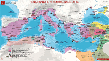
The Roman Republic before the Mithridatic Wars, c. 90 BCE
A map illustrating the geopolitical landscape in the Mediterranean on the eve of the Mithridatic Wars (88 - 63 BCE). The aftermath of the Punic Wars had left Rome the dominant power in the Mediterranean - with Roman rule extending from the...
Image
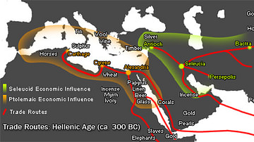
Hellenistic Trade Routes, 300 BCE
Alexander the Great died in Babylon on the 13th of June, 323 BCE. His Macedonian-Greek empire broke apart, but Alexander’s heritage was felt throughout the ancient Mediterranean world for centuries. Three Hellenic empires emerged from the...
Image
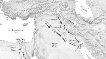
Tigris, Euphrates, & Nile River Flows
Map showing the Tigris and Euphrates Rivers flowing from north to south into the Persian Gulf, and the Nile River flowing from south to north into the Mediterranean Sea.
Image
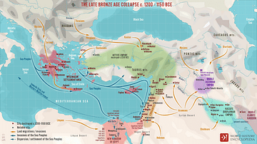
The Late Bronze Age Collapse c. 1200 - 1150 BCE
A map illustrating the sudden, chaotic downfall of numerous interconnected civilizations in the Aegean, Eastern Mediterranean, Anatolia, and Mesopotamia toward the end of the Bronze Age (c. 1200 BCE). The great kingdoms and empires of the...
Image
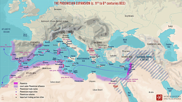
The Phoenician Expansion c. 11th to 6th centuries BCE
A map illustrating the expansion of the Phoenicians, including the trade routes and process of Phoenician colonization, from its origins in the Levant region of the eastern Mediterranean, until its height when it spanned from Cyprus to the...
Image
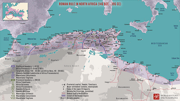
Roman Rule in North Africa (146 BCE to 395 CE)
A map illustrating the scope and organization of the Roman provinces in North Africa. Since the establishment of the first Roman territory on the continent (roughly corresponding to modern Tunisia) in 146 BCE following the destruction of...
Image
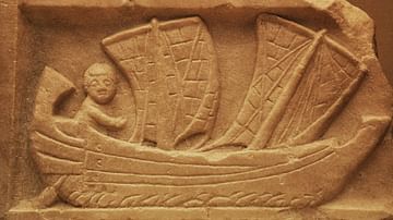
Corbita Sailing
This marble relief shows a man sailing a corbita, a small Roman coastal vessel with two masts. Found at Carthage, most likely produced in Africa Proconsularis (modern-day Tunisia) circa 200 CE. The corbita's sails were most likely made...
Image
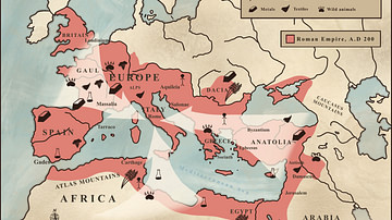
Trade in the Roman Empire Map (c. 200 CE)
This map shows the major sources of trade goods in the Roman Empire, circa 200 CE. The map shows the sources of the following trade goods: grain, olive oil, slaves, wine, metals, textiles and wild animals.
Image
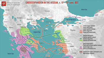
Greek Expansion in the Ancient Aegean
A map illustrating the trends and directions of the expansion of the ancient Geeks across the Aegean during the so-called Greek Dark Ages in the wake of the collapse of the Mycenaean civilization. During the 1100s BCE, fueled by a variety...
Image
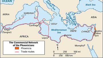
Phoenician Trade Network
Map of Phoenicia and its trade routes.