
Illustration
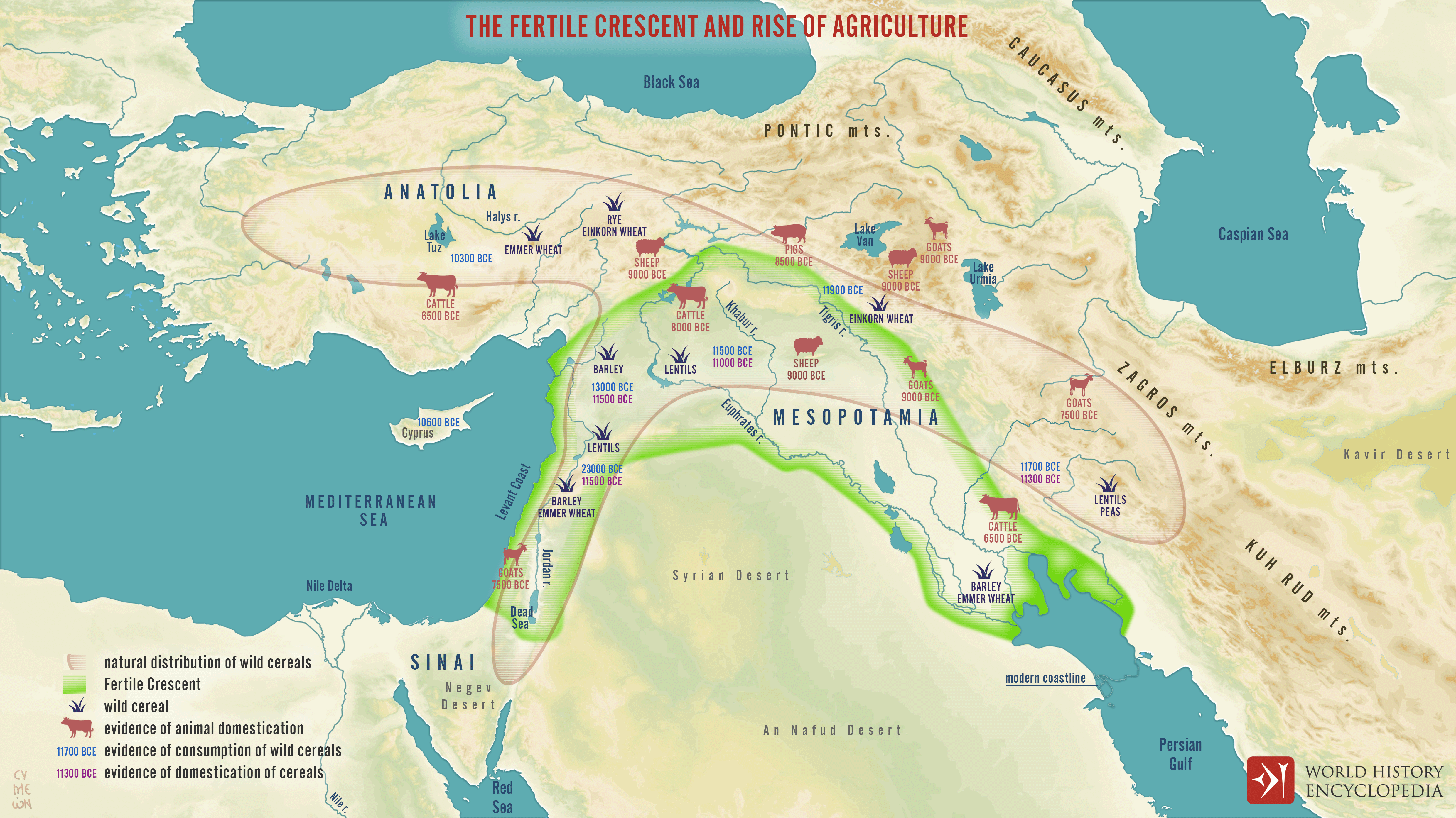
A map of the Fertile Crescent showing the Eastern Mediterranean, Anatolia, and Mesopotamia. Key agricultural produce is shown on the map, including early cereals and animals, as well as the dates of first known agriculture.
About the Author

Simeon is a freelance visual designer with a deep interest in the human side of history.
He believes that every image should be an interaction, a commentary, and a narrative, and every map should lead on an exciting journey of exploration and discovery.
Related Images
Image
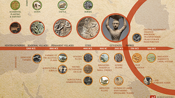
Agriculture in the Fertile Crescent and Mesopotamia - Timeline
A visual timeline illustrating the evolution of agriculture in...
Image
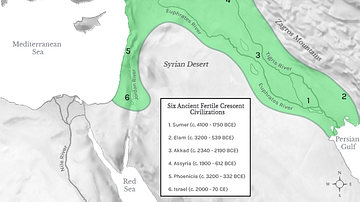
Fertile Crescent Map
Map of the Fertile Crescent, a region stretching in a quarter-moon...
Image
Map of the Fertile Crescent
This map shows the location and extent of the Fertile Crescent...
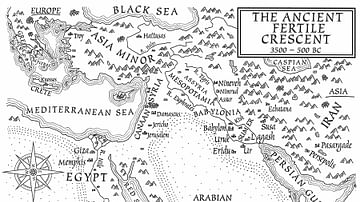
Image
A Map of the Ancient Fertile Crescent (From the Novel "The Jericho River")
An illustrated map of the ancient Fertile Crescent, 3500-500 BCE...
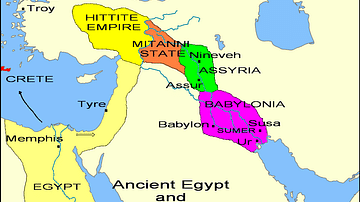
Image
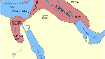
States of the Fertile Crescent, c. 1450 BCE
A map illustrating the various political states within the Fertile...
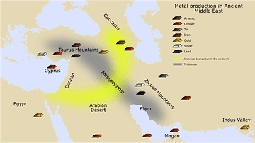
Image
Ancient Near Eastern Metal Production
A map showing the major sites of metal production in the Ancient...
Cite This Work
APA Style
Netchev, S. (2020, August 05). Map of the Fertile Crescent. World History Encyclopedia. Retrieved from https://www.worldhistory.org/image/12521/map-of-the-fertile-crescent/
Chicago Style
Netchev, Simeon. "Map of the Fertile Crescent." World History Encyclopedia. Last modified August 05, 2020. https://www.worldhistory.org/image/12521/map-of-the-fertile-crescent/.
MLA Style
Netchev, Simeon. "Map of the Fertile Crescent." World History Encyclopedia. World History Encyclopedia, 05 Aug 2020. Web. 24 Apr 2024.