
Illustration
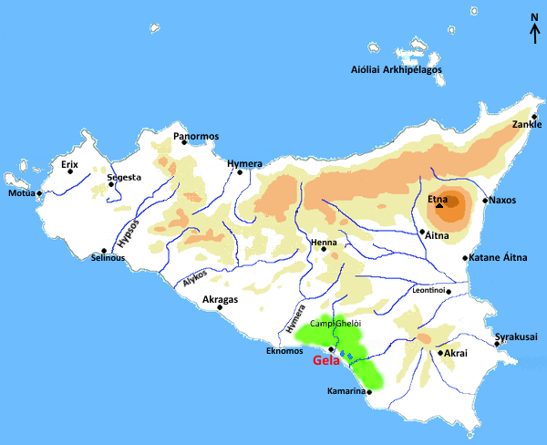
A map indicating the principal towns in Sicily during the 5th century BCE.
About the Author

Salvatore Piccolo is an archaeologist. His excavations include the dolmens of Sicily where in "Cava dei Servi", he found human remains and ceramic fragments that have unravelled the mystery of the function and chronology of Mediterranean dolmens.
Related Images
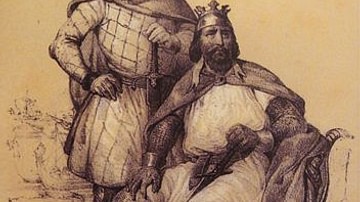
Image
Robert Guiscard and Count Roger
Robert Guiscard and Count Roger, the oldest and youngest Hauteville...
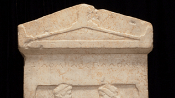
Image
Grave Stele of a Couple, 5th Century BCE
Greek grave stele depicting a couple greeting each other, affectionately...
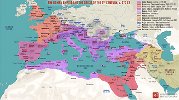
Image
The Roman Empire and the Crisis of the Third Century, c. 270 CE
A map illustrating the state of affairs in the lands of the Roman...
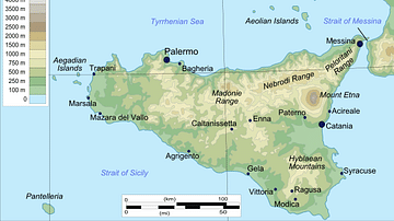
Image
Topographical Map of Sicily
Topographical map of Sicily.
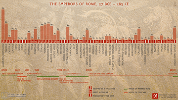
Image
The Emperors of Rome, 27 BCE - 285 CE
An infographic depicting the timeline of the emperors of Rome from...

Image
5th Century BCE Demareteion Coin
An illustration of the so-called Demaretéion is a silver coin of...
Cite This Work
APA Style
Piccolo, S. (2017, December 19). Map of Greek Sicily, 5th Century BCE. World History Encyclopedia. Retrieved from https://www.worldhistory.org/image/7776/map-of-greek-sicily-5th-century-bce/
Chicago Style
Piccolo, Salvatore. "Map of Greek Sicily, 5th Century BCE." World History Encyclopedia. Last modified December 19, 2017. https://www.worldhistory.org/image/7776/map-of-greek-sicily-5th-century-bce/.
MLA Style
Piccolo, Salvatore. "Map of Greek Sicily, 5th Century BCE." World History Encyclopedia. World History Encyclopedia, 19 Dec 2017. Web. 18 Apr 2024.